Cruisin’ Into the New Year: Technological Advancements and Innovation
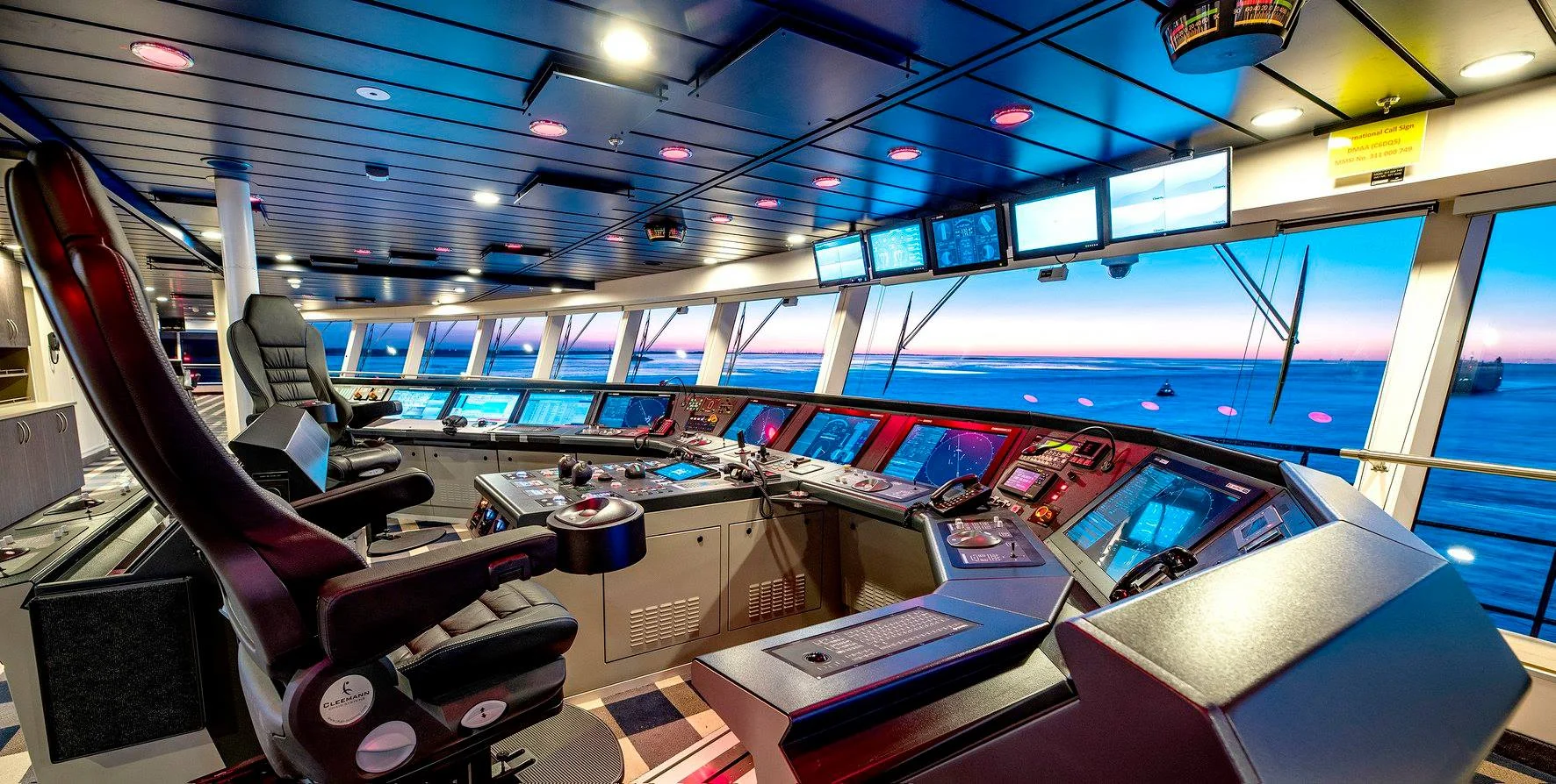
Picture it – the holiday season, 2023. Imagine that you have decided to forego hosting a holiday gathering at your home, nor are you going to travel from house to house to visit with family and friends while spreading holiday cheer and dropping off gifts. Santa already has that part covered anyway, right? This year is going to be different. This year, you have decided to spend your holidays having a bit of fun in the sun. You’re going on a cruise!
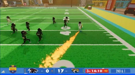
In September, my beloved Atlanta Falcons played the Jacksonville Jaguars in an NFL game in London. If you don’t follow the NFL, you might think it unusual that they played in Europe, but actually they play a handful of games in Europe every year. The unusual part was that the game looked like the picture above. Not the traditional warriors of the gridiron that we’re accustomed to, but animated caricatures of football players that looked like kids action figures.
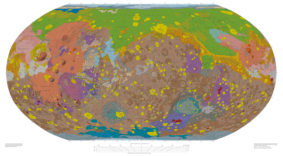
Space may be the final frontier for human exploration, but it is just the beginning for the next generation of GIS developments and emerging technologies. Ever since Galileo first observed Mars in 1610 through his primitive telescope, human civilization has been fascinated by the red planet. However, it has only been in the last fifty years that scientists have been able to truly enhance their understanding of Mars’ surface and begin answering important questions about the possibility of life outside of our atmosphere.
Space may be the final frontier for human exploration, but it is just the beginning for the next generation of GIS developments and emerging technologies. Ever since Galileo first observed Mars in 1610 through his primitive telescope, human civilization has been fascinated by the red planet. However, it has only been in the last fifty years that scientists have been able to truly enhance their understanding of Mars’ surface and begin answering important questions about the possibility of life outside of our atmosphere.
In 1971 in the wake of the moon landings, the Soviet Union successfully landed the “Mars 3” mission on the surface of the red planet. This feat of science has since been accomplished by the United States and China, and these combined missions have provided vital information to space agencies around the world. These landings, in conjunction with orbital satellites, have served to map the surface of Mars and provide input for future manned and unmanned missions. The question is, how is this research being done and how can we use such pioneering techniques to help understand our own planet?
We are all probably familiar with the various Mars rovers that have stolen the headlines. Tiny, unmanned crafts patrolling Mars’ surface like a live-action Wall-E. Though, what are these rovers accomplishing by acting as interplanetary Roombas? The Rovers serve several roles. The first role is as a rolling laboratory identifying soil samples, taking atmospheric readings, and determining suitability for later manned missions. The second, and the focus of this article, is their role as surveyors communicating geographic data back to earth to allow GIS professionals a chance to map and analyze Mars without ever having set foot on the planet. The way the rovers accomplish this is through a partnership with overhead satellites and the application of advanced imagery techniques.
In 2001, NASA launched the Mars Odyssey which orbits the red planet and uses a suite of sensors to map and measure the surface of Mars. This suite, known as THEMIS (Thermal Emission Imaging System), uses traditional visible spectrum imagery as well as multispectral and hyperspectral imaging to generate detailed models of the planet’s surface and composition. For information on how hyperspectral imaging accomplishes this, click here. These images are then read by geologists and cartographers to identify and map the terrain features of Mars, enabling GIS analysts to determine future mission goals for the various rovers, and these rovers in turn act to validate the findings of the satellites.
Thanks to earlier findings and topographic insights, the 2021 Perseverance mission is equipped with some of the most robust maps of Mars to date. One of the techniques pioneered for this mission was the use of Terrain Relative Navigation. This technique is vital when navigating through the heavy dust and storms that the red planet is known for. This technique utilizes imagery and AI/ML to ensure a safe landing and to help orient the rover in an otherwise unknown location. Upon initial landing, Perseverance uses its onboard cameras to take pictures of the terrain below. These pictures are then compared to orbital imagery collected prior to the mission. Based on trajectory and sensor input, the landing can be adjusted to ensure accuracy and safety for the rover. This technique will be vital once we begin sending manned missions to the treacherous landing zones. The Lander Vision System (LVS, nicknamed Elvis) is only alive for twenty-five seconds, but in that time, it is processing one image per second on approach. These systems are using pattern matching to identify at least twenty matches for terrain landmarks, though NASA has said that Elvis typically produces many more matches, sometimes as many as one hundred and fifty. These patterns are then used by the Safe Target Selection System (STSS) to determine if the lander is on approach to a predetermined safe zone, or if the lander needs to make course corrections.
Another technique to come out of the current Mars exploration is the use of multispectral infrared imagery to determine the presence of water and miniscule amounts of moisture in the Martian soil. Infrared imagery is nothing new and has been used on earth for some time now. What sets this technique apart is the fact that Mars imagery is identifying past water deposits and trapped glacial deposits on and below the surface. These kinds of techniques have huge implications for science back on earth as they can be used to help better understand historic flood and climate patterns as well as the impacts that human civilization has had on these. For example, these techniques may be used in areas of Africa to study the process of desertification and enable scientists to develop methods for better combatting this phenomenon. Additionally, in areas that have recently experienced historical levels of flooding, this level of hydrographic analysis could allow emergency response agencies to determine what factors placed these areas in the path of danger, allowing similar areas to mitigate these factors before disaster strikes.
Lastly, the combination of overhead and ground remote sensing on Mars has allowed GIS professionals to begin the arduous task of developing a coordinate system to accurately reflect locations on maps. This task was long ago accomplished on earth by astronomers and explorers charting routes, stars, and land features to develop a cohesive picture, and other than missing an entire continent, they didn’t do half bad. While this may not seem like a monumental achievement, accurate mapping and coordinate systems are what enable many of the devices we rely on here on earth to precisely measure our relative locations and thereby feed information to us related to that spatial data. While it will probably be a while before Martian colonists need directions to their nearest STAR-bucks, it will be important for them to know directionality and fastest or most economical course when returning to a home base with limited supplies. This coordinate system will also be essential in directing satellites for inter-planetary communications relays, as well as accurately plotting trajectory of supply missions and one-way payloads. When it comes down to the physics of it all, when you are trying to hit a moving object, from a moving object, with a moving object, it is indeed rocket science, and having an accurate representation of your target area is vital in making precise calculations.
Overall, the GIS technologies and techniques being used on Mars may not equate to gigantic scientific breakthroughs, but it does highlight the value of thinking outside of the box in situations where normal just won’t cut it. Reminding ourselves of this fact enables us to test the boundaries of what is possible and allows us to look at projects in a new light. Perhaps in the future LVS and STSS type programs can be used to allow safer autonomous landings for UAV flights, commercial airlines in autopilot, or even emergency landings in the event of an incapacitated crew. Maybe the innovations of multi-spectral hydro-detection can be used in the analysis of shrinking ice caps, or in determining pollutant composition and saturation in the Amazon. It could be that the work in developing an accurate coordinate system for Mars enables us to better map the depths of our very own oceans. I hope that by looking at the innovations in mapping technologies related to Mars, you can see that no idea is too out of this world!
It’s that time of year. Students of all ages are gearing up and heading back into the classroom. From preschool to graduate-level students, there are class lists, schedules, and supply lists. So, let’s make sure you’re ready. Pencils… Yes. Notebooks… Yes. Crayons… Of course! AI tools… the what?
Location-based technology allows for the use and analysis of space, time, and geography in order to make an educated guess about a device’s current and even future whereabouts. Like most things, there are both advantages and disadvantages to this type of technology.
Imagine you take your car to an AI mechanic for repairs. Instead of a human attendant asking you about the car, you talk to ChatGPT for a few minutes about the problems and it devises a solution. Automated robots then roll out and spring into action, fixing the issues in a matter of minutes, instead of the hours that you’re used to waiting on a typical visit. This automated application of AI systems can save humans time and effort while, in many cases, also performing tasks more accurately.
Generative AI has brought about a significant impact on TV and movie writers, revolutionizing the way stories are created and developed. With the advancements in natural language processing and machine learning, generative AI models have become capable of generating coherent and creative narratives, characters, and dialogue. This technology has proven to be a valuable tool for writers, serving as a source of inspiration, assisting in plot development, and even providing alternative ideas. By feeding vast amounts of existing scripts and narratives into these AI models, writers can explore new storylines, experiment with different genres, and overcome writer’s block. However, while generative AI offers a wealth of possibilities, it also raises ethical questions and challenges traditional notions of authorship and creativity. Striking the right balance between human ingenuity and AI assistance is crucial in preserving the unique vision and storytelling abilities of TV and movie writers.
Are we Living in a simulation? Maybe soon enough we can! Before the walls went up and construction of IG Labs was made a reality, we were given a glimpse of the grand vision with virtual reality. Thanks to modern technology, we were able to walk through and see what would eventually become our own personal “Tech Shangri La”. But outside of being a neat toy for the digital age, what are the practical uses of this kind of technology?
In our age of brain tickling nose swabs, there is a renewed interest in fast, accurate, and non-invasive tests for diagnosing illnesses. We’ve all probably experienced a Q-tip going just a little too far at some point in the last couple of years. Well researchers from University of South Florida, Cornell, and 10 other institutions are working with the National Institutes of Health to develop AI that could make medical diagnoses based on a person’s speech.